A free app for Android, by SPH Engineering.
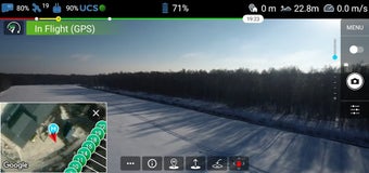
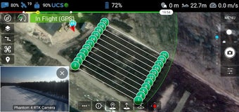
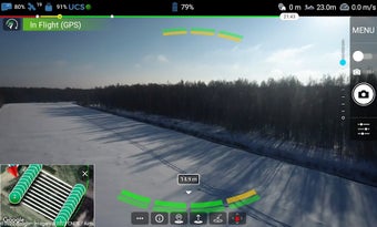
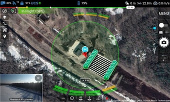
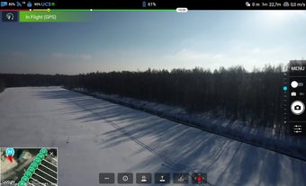
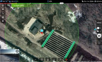
UgCS is an area-scanning platform for construction sites. It is a complete platform for automated mapping and photogrammetry, and it provides a method to upload data directly to your computer. The platform can be used as a stand-alone application to plan and fly a drone mission, as well as a method to upload data to your computer. The platform is fully compatible with the DJI drone.
How to use it?
Connect with the UgCS desktop to enjoy all its features. You will have access to the flight simulator, live HD camera, view, manual flight mode, telemetry data, and many more.